Will it ever melt? Cross your fingers for Friday, Saturday

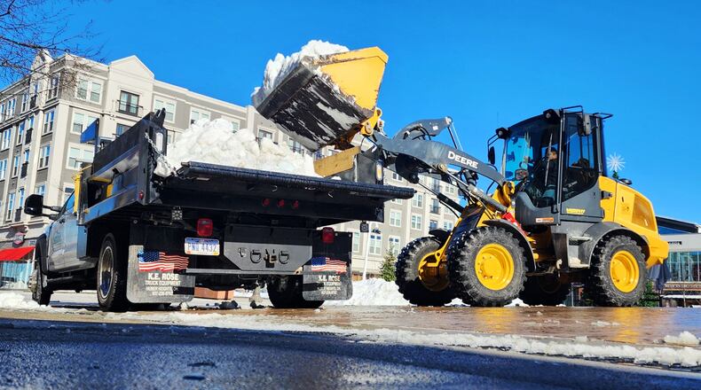
A crew Oberson's Lanscaping cleans up snow Monday, Jan. 13, 2025 at Liberty Center in Liberty Township. Over a foot of sbow fell in two rounds of winter weather last week. NICK GRAHAM/STAFF

Credit: Nick Graham

Credit: Nick Graham

A crew Oberson's Lanscaping cleans up snow Monday, Jan. 13, 2025 at Liberty Center in Liberty Township. Over a foot of sbow fell in two rounds of winter weather last week. NICK GRAHAM/STAFF

Welcome to Day 11 of snow-covered southwest Ohio, and unfortunately (unless you’re a sled salesman) we’re still a couple of days from seeing that change.

No, it isn’t normal for our region to have snow cover for nearly two weeks. But combine the largest two-day snowfall many areas had seen in a decade, and day after day with highs in the 20s or very low 30s, and that’s what you get.

The snowpack (6-10 inches fell Jan. 5-6) melted a tiny bit Sunday when temperatures peaked above freezing, but it will take more than one mild-ish day to do it.

After highs around 20 Wednesday and in the low 30s Thursday, temperatures are forecast to reach the high 30s or maybe even touch 40 on Friday and Saturday.

National Weather Service meteorologist Matthew Campbell said cold and clouds are the enemy of melting, so Friday’s sun and Saturday’s rain could do the trick ... except for the giant parking lot snow piles that could be with us into February.

“In terms of significant melting, if we do get into the upper 30s plus rain, that can do a number on the snowpack,” Campbell said. “Forty (degrees) and sunshine can do it, too.”

Proof that your grass does still exist could be just around the corner.

About the Author