“There are probably about 60 homes” affected, as well as several businesses, said Larry Bagford, a planning and zoning specialist for Hamilton, who also serves as the city’s floodplain administrator.
That’s because the Federal Emergency Management Agency since 2011 has been working to revise flood-hazard maps across Butler County to experience the amount of flooding expected during a 100-year period. Implementation of the newly calculated flood zones, based on the best information and computer models available, was delayed after Hamilton appealed FEMA’s earlier flood-area calculations.
The insurance can cost owners hundreds of dollars per year, if not more. But those who buy insurance before the new flood maps take effect in October will receive the same rates as before the risk area takes effect, said Laurie Smith-Kuypers, an outreach specialist for FEMA Region V.
Potential flooding of Two Mile Creek is unrelated to the causes of other flooding that has struck Hamilton’s West Side, particularly along Main Street and in the Highland Park neighborhood in recent years.
“We have to buy insurance,” said Randy McMahan, a Thomas Boulevard resident whose property is next to Two Mile Creek.
“Being next to the creek, we were in the area no matter what,” McMahan said.
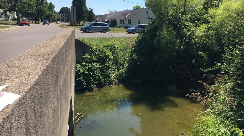
Still, there are other things he and neighbors believe the city can do. For one thing, when the creek passes under Thomas Boulevard, there’s a support pillar in the middle of the bridge that traps logs and other debris, creating a temporary dam that worsens flooding, McMahan said.
“It came up to our driveway last year, and then it stopped, and then it receded,” he said.
He has called the city a few times to let officials know about blockages.
“They do send people to clean it out,” he said, but he and nearby resident Jean Brown believe crews should clear debris more regularly.
Brown, a longtime York Avenue resident, remembers a flood that hit in 1979 or 1980, displacing her family for a couple weeks.
She’s considering buying flood insurance, but said even when there’s flooding there won’t necessarily be payouts. After the earlier flood, her parents didn’t receive insurance benefits because it wasn’t considered a disaster area, she said.
Bagford said the Two Mile Creek area “had never been studied, so folks who had bought their houses, with these new map studies, there were areas that were going to be affected.”
Bagford said Hamilton hired its own engineering consultants, who provided FEMA more information to use in its calculations, such as the locations of rain drainage basins that pour into Two Mile Creek.
“So we did get some adjustment to it, narrowed it down some,” perhaps removing 20 to 30 properties from the flood zone, Bagford said. “But one thing that FEMA stresses is just because that flood line stops at your neighbor’s property doesn’t mean that’s what’s going to happen, if it ever gets to that point.”
In other words, just because you’re not in the flood zone doesn’t mean you won’t get flooded.
“I don’t like to be a salesman for flood insurance,” Bagford said. “I don’t feel that’s my job. I feel that my job is to let people know these are the requirements. They can work with their agents. And a lot of times, I have to answer questions for agents. And if I can’t answer them, I’ll direct them to someone who can, at FEMA Region V.”
The city has informed everybody who is affected about the situation. For some, their properties — but not the buildings on them — are affected, which should save them insurance costs. Those without federally backed mortgages, or without any mortgages, need not buy insurance, although some said they are considering doing so anyway.
Also receiving letters about the new flood areas are the banks that hold the mortgages.
Thanks to highly accurate digital mapping, the city is able to help owners determine whether their buildings are in the flood zone and provide elevation certificates, which indicate the building is beyond the flood area, Bagford said. If not, they can avoid obtaining insurance. On the other hand, “some houses are dead in the middle of this flood-hazard area,” he said.
The city will be letting people who may benefit from elevation certificates know about its offer to help them avoid insurance.
Here’s advice from Smith-Kuypers, of FEMA: “Property owners located in the floodplain should always ask their agent to provide two quotes — an actuarial or real-risk quote or a subsidized quote — and choose which policy best fits their needs and financial situation.”
“If they go now and get it, they get it at the preferred rate, at the rate the property is currently designated,” Bagford said. “They will continue to have that rate, but over time, that rate is going to be increased until it gets to the actual rate of anybody else in a floodway. So it helps them out for the first few years.”
About the Author
